File:600x748-Carte-de-l'Irlande-R.jpg
Jump to navigation
Jump to search

Size of this preview: 481 × 600 pixels. Other resolutions: 192 × 240 pixels | 600 × 748 pixels.
Original file (600 × 748 pixels, file size: 108 KB, MIME type: image/jpeg)
Captions
Captions
Add a one-line explanation of what this file represents
| Description |
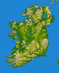
Français : Carte topographique d'Irlande redimenssionnée pour la géolocalisation |
||||
| Date | Wikisoft* @@@-fr 07:52, 11 December 2010 (UTC) | ||||
| Source |
NASA SRTM |
||||
| Author | Wikisoft* @@@-fr 07:52, 11 December 2010 (UTC) | ||||
| Permission (Reusing this file) |
|
||||
| Other versions |
|


File history
Click on a date/time to view the file as it appeared at that time.
| Date/Time | Thumbnail | Dimensions | User | Comment | |
|---|---|---|---|---|---|
| current | 07:52, 11 December 2010 | | 600 × 748 (108 KB) | Wikisoft* (talk | contribs) | {{Information |Description={{fr|1=Carte topographique d'Irlande redimenssionnée pour la géolocalisation}} |Source=NASA SRTM (redimenssionée pour la géolocalisation) |Author=~~~~ |Date=~~~~ |Permission={{GFDL-GMT}} |other_versions=[[Category:Maps o |
You cannot overwrite this file.
File usage on Commons
The following 3 pages use this file:
File usage on other wikis
The following other wikis use this file:
- Usage on arz.wikipedia.org
- Usage on en.wikipedia.org
- Usage on eo.wikipedia.org
- Usage on es.wikipedia.org
- Usage on it.wikipedia.org
- Achill Island
- Benbulben
- Isole Aran
- Omey Island
- Errigal
- Croagh Patrick
- Carrantuohill
- Capo Malin
- Baia di Donegal
- Baia di Galway
- Capo Mizen
- Baia di Clew
- Clare Island
- Lough Gill
- Killary Harbour
- Lough Corrib
- Lough Derg
- Árainn Mhór
- Mweelrea
- Lough Conn
- Lough Cullin
- Oileán Thoraigh
- Inis Mór
- Inis Meáin
- Inis Oírr
- Isole Skellig
- Skellig Michael
- Little Skellig
- Inishtrahull
View more global usage of this file.